
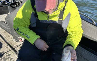
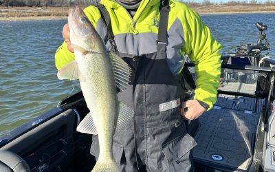
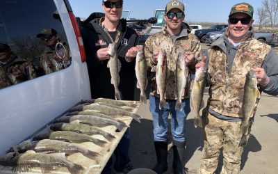
Modern technology and its impact on fishing as a whole, is quickly becoming more common and in some situations, extremely controversial. I’m sure everyone reading the first sentence of this article thinks I’m talking about the fish-catching impact. Of course, it all goes hand and hand. I’ll touch on that a little more here, but it’s not the main focus of this article.
Growing up in the late ’70s and ‘80s on the Missouri River near Bismarck we were sort of pioneers. Very few folks were fishing the river locally back in those days. If you saw another boat it felt like trespassing and at times it felt crowded. Oh, how I wish I had a crystal ball back in those days to see what it has become today.
Everything learned was by trial and error. The old green box flasher was your eyes and ears for basically not running up on a sandbar. The fishing holes were ones of slower current and depth.
The only way to find a fish in these spots was to catch them. No shortcuts to the ultimate prize of fish on a stringer. Another obstacle was not hitting a deadhead or log. You had your eyes glued to the water trying to avoid the telltale v shape in the current that could end a fishing trip in a blink of an eye.
Nowadays, those stumps are marked on GPS with a skull and crossbones symbol. The trails or navigational route is characterized by a line on your graph you can follow and spots don’t necessarily need to be fished anymore to know if fish exist.
Unlike today’s advances in technology, the only way to find fish was to drop a line in the water and hope you got bit. If you did get bit you knew there was life in the spot. After a bite or after you caught a fish you would try and figure out the spot/structure in more detail.
You learned a lot by this method no doubt! A person always tried to visualize what was below the surface. Lake Sakakawea back in the day wasn’t much different. No contour maps to find the islands, points, breaks, etc. You had to put your time in on the water. There was no substitute for actual time on the lake. It wasn’t a quick text, Snapchat, screenshot of a waypoint, or website report to go try.

Some of the younger readers will have no idea what I’m talking about next. One of the biggest advancements was the Loran GPS. I don’t remember what the technical term was for these units. But the unit came with a big antenna and it triangulated satellite towers and it allowed you to mark waypoints.
I don’t remember the distance, but the government had a block on these systems so it would only get you so close to where you marked the spot. Not exactly on it, which at times was very frustrating. This unit was still better than counting power poles on the highway and getting visual with an object on the opposite shore and chucking out a buoy to try and mark the spot.
Heck, I remember circling the east end of Lake Sakakawea staring at my Hummingbird Super 60 looking for humps to fish.
I giggle now thinking about all the stuff we did to try and mark and figure out spots. All my circling around in a 16-foot Yar-Craft tiller prepared me well. Especially while I was fishing the PWT back in the late 90’s early 2000s. This was the front edge of major technology!
I was fortunate enough to be teamed up a couple of years with an electronic legend, by the name of Bruce “Doc” Samson. Many of you have been to his classes or have purchased one of his SD cards. He and another guy by the name of Warren Parsons had this software called Fagawi. I believe it was designed to read a program called Dr. Depth. They were using it on a computer to have the ability to see structures on lakes like Devils Lake via satellite images from when the lake was at its lowest point.
Knowing what I know now, especially after transferring a bunch of waypoints from one of my old tournament SD cards, we had things marked that I now can identify better by just looking at a Doc Sonar chip right on my Lowrance. The technology, especially back in the late ’90s, and early 2000s, Doc had going was amazing to me. He had his computer mounted in his boat just like we do depth finders today.
The hours Doc and I spent on picnic tables or inside a camper in the middle of campgrounds across the country are truly incredible! These times I will never forget these and cherish them just to be able to tell this story today. If you are reading this Doc, thank you for everything you taught me!
This leads me to my next thoughts on all of this. I feel bad for all the guys that spent countless hours trying to find these sweet spots like old sloughs, brush piles, ditches, culverts, old roads, drainages, etc because now anyone who purchases one of these chips has that information at his or her fingertips.
It’s just like side imaging and anchor lock back on the Missouri River where I cut my teeth in walleye fishing. Both are absolute game-changers! You don’t need boat control as a skill anymore, which at one time was a true art form and a talent. If you were good at it, you had an advantage.
Another thing about the new way of fishing, is you don’t need to drop a line in the water and be able to see if the spots have fish. You can cruise into an area with side scan, 360, and perspective mode on the Livescope, coupling that with satellite imagery and or lake master chips, and you can find the spot on a spot in rather short order. Those same spots the old guides, river rats, etc found by trial and error are pretty much out there and visible on some sort of technology available today.
I get it, there are still little detail things that only time spent fishing or drilling holes in the winter will put you on the prime spot and you still need to get the fish to eat. The unfortunate part or for some the fortunate part is the hours upon hours the older guys put in are shorter for the younger generation.

Another form of technology that plays heavy on things in the fishing world today is cell phones. Word travels fast via text messages, Snapchat, and even photos on a social media page, guys will break down the backgrounds to figure out where you are at. I’ve even been told people will check locations on those pictures or look at the Snapchat location service to figure it out also. Crazy that extreme people will take things to get an advantage.
A hot topic has surfaced recently about the selling of waypoints or waypoint sharing websites or mobile apps. I’m not sure how I feel about this. If a guy wants to give up his or her spot that they found, that’s one thing, but if he or she is giving up someone else’s spot/area, that’s a whole other situation. This is an ethics question. Some murky waters there.
One of my old now passed on relatives had a cabin on a crappie lake in northern Minnesota. He had the best crappie spot year after year. On his property, he had an old tree and a post he put on the shore somewhere. After he had these in place, he tied ropes. Every winter he would hook the ropes up to the post and tree and walk out on the frozen water. When the ropes touched in a certain spot he knew he had his spot. He had it so dialed to the inch how to situate his fish house to be on the sweetest spot on the spot.
Guys would surround his shack every winter and could never catch the crappies off that spot as his shack would. We see it all the time up here on Devils Lake guiding. The saying in winter fishing is 5 feet is a mile. Anyway, when his cabin went up for sale after he passed away, the potential buyers offered a ton of money more for the place if the ropes came with. I know for certain he would have never sold those ropes while he was still living.
Before he passed away he had multiple guys offering him a lot of money for those ropes. Cool story for sure! It just goes to show you it’s hard for the older generation just to give up their secrets. This brings me back to the waypoint of sharing stuff. I’ve watched numerous times an area just gets bombarded with out-of-state fishermen overnight. Upon investigation and asking a few of them how they found the spot they said easy, we bought a waypoint.
All this techie stuff available to everyone saves time searching for good fishing areas. It’s nice to have a starting point or an idea of maybe what to do and where.
I still personally love the feeling when you find fish or figure something out on your own. It may not always be a new spot. Chances are it’s not a new spot. A lot of times in today’s age it’s all about timing. I’ve learned this over the past 5 years guiding full-time, ice fishing especially. Chances are pretty slim a guy like myself is going to find something completely new. It all boils down to putting the time in and looking around trying to time an area of the lake.
I will admit this, it sure is nice to be looking around with all the new technology I’m able to use. I do truly admire the guys that were doing this before all this stuff. You guys are the true pioneers!
0 Comments